How do I get there?
Navigation is the art of moving with purpose, usually from point A to point B, although in practice C, D, and E may come into play, and sometimes B is missed completely. As we journey most of us are at least occasionally looking for reassurance milestones, indicators that we are indeed on the right path. During navigation we may find ourselves cycling through various emotions including autopilot confidence, mild uncertainty, and complete and total befuddlement. One of the strongest influences of our emotional state is our ability to resolve conflicting information. The better the navigation skills and tools we possess the more likely we will resolve these conflicts quickly and with confidence.
There are a variety of techniques to maintain navigation confidence. I cluster them into these navigation categories: reading trail signs, a map, a compass, a GPS device, and reaching out.
Navigating Using Trail Signs

Navigating with trail signs relies on our ability to compare what we believe we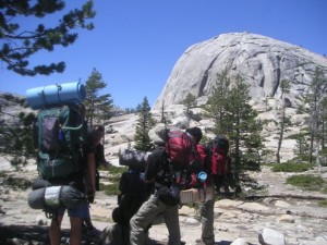 know about a particular route with what we are experiencing in the moment. We may have been told (or may be recalling from memory) a variety of relative information.
Start at the Meadows trail head, follow it down to the creek, when you get to the creek, rather than crossing as the trail does, follow the creek upstream. Where the creek splits, stay to the left. Keep going until you reach the waterfall. You can’t miss it, it is the only one.
Current location for environment only reading is limited to the milestones we are mentally tracking.
I am somewhere between the trailhead and the creek . I am between the creek crossing and the creek split.
While environment reading, we usually search for other confidence building signs like trail markings, such as blazes, cairns and ducks.
This trail blaze means I’m probably on the main route . This rock pile proves others have followed this creek; I am pretty sure I am going the right way.
During these readings, conflicts arise when milestones take too long to be met, or when they appear out of order .
I have reached a waterfall, but I never saw the creek split, and this water fall does not seem as big as I was expecting. Did I inadvertently follow the wrong creek split to a smaller water fall?
Trail reading, though helpful, rarely gives us the complete navigation confidence we desire.
Navigating With A Map
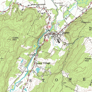

Map reading allows us access to a more detailed accounting of landmarks such as waterways, vegetation, elevation change, and various coordinate locations. By referring to a map regularly, we can anticipate detailed milestones along our journey.
In about 3 miles the trail will turn to the east, rise up 500 feet over the saddle, and then drop down 300 feet to the lake. We will be above the tree line for a while, traveling on open granite, then re-enter the tree forest near the lake.
As you experience these things, your confidence remains high. One challenge with map reading is that sometimes we do not actually become map readers until we are conflicted.
This does not seem right. I thought I would be able to see the lake from here. Did I climb up the right saddle? I was planning to refill my water from the lake. Where am I?
Having a map does not mean you know where you are on the map. It takes both map and environment reading skills to resolve that.
I am standing by a steep rock outcropping, and there is a prominent peak over there in the distance. Where could I possibly be on this map so that those things are true?
Maps are most helpful when we know where we are on them. Keeping track as we go is much easier than figuring it out after we are lost. If we cannot easily deduce where we are on the map, we may even start to question if we have wondered off the edges of the page.
Navigating With A Compass

Compass reading, when performed correctly, provides us with another important tool in navigation: confidence in direction.
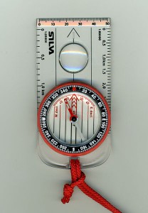
According to my map the trail I want should turn north-north-east, yet I am not sure this is really north-north-east. Am I on the right trail?
A compass can be used to help us orient our map, establish our direction of travel, and triangulate our location on the map based on visible milestones.
Many of us realize a compass is not influenced by geographic north, but rather “magnetic” north. What may surprise some, however, is that even then it does not actually point to the location of the magnetic pole, but rather aligns its needle will with the local magnetic field. Ugh, could it be any harder? Well yes, to make matters worse, magnetic north moves over time, and not at a constant rate or direction. In general, magnetic north is in the Canadian Arctic. So in the western US, a magnetic compass will point too far to the east. In the eastern US, a magnetic compass will point too far to the west. If, however, you are between Lake Superior and New Orleans , you are in luck: a magnetic compass and geographic North are currently aligned.
Before you give up completely, all this really means is you need current information to make the appropriate correction between your magnetic compass and true north. This correction, known as declination, is indicated on most quality topographical maps. Because it changes over time, however, make sure the map you are referencing is current. A map from the San Francisco Bay area from 1961 will show a declination of 17 degrees, yet in 2011 is only 14 degrees. Depending on how far you are traveling, being off by 3 degrees can be quite significant.
Most of us consider a compass to be an effective navigation tool, but too few of us practice the skills of actually using one.
Navigating with a GPS (Global Positioning Satellite) Device
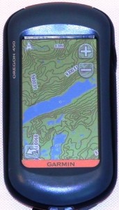
GSP reading provides us with a very precise view of our location. By monitoring signals from multiple satellites, and by performing fancy mathematical calculations based on time stamps, known orbits, error correction, and other black magic, a hand held GPS can provide us with our location coordinates within a matter of feet. This information can then either be translated to a physical map, or with some devices, displayed directly on an electronic topographical map. Maps and GPS devices can use a variety of different coordinate systems (such as longitude/latitude or UTM). When translating from a GPS to a physical map, make sure both are using the same coordinate system, or your results may be misinterpreted. When done correctly, however, it is like carrying around a magic sign from the shopping mall that says “you are here.”
Reaching Out
Perhaps a result of our social narcissism, or maybe just the logical evolution of texting, Facebook, and Twitter, but we seem to have come to the conclusion that telling others
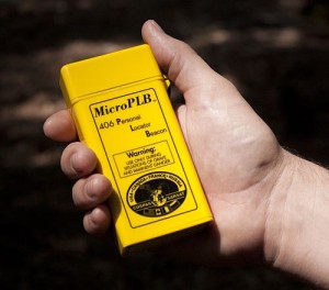
everything about ourselves, including our current location, is highly desirable. Frankly, it just seems like the courteous thing to do to satisfy the cravings of our adoring fans. From an emergency standpoint, being able to beacon location to our rescuers seems logical, but reaching out is so much more. What about our family and friends who want to know we that we are out adventuring, that we are still on our plan, doing things so much more interesting than what they are doing. There are a variety of ways to reach out, including cell phones, satellite phones, and beaconing devices. Who doesn’t want to here the following conversation:
Oh Hi, it’s me. Just wanted to tell you we are standing at the top of the summit. It is absolutely gorgeous here. You really should be here.
Some devices, such as the SPOT, actually transmit our navigational progress so our family and friends can track our exact location on a map.
